Red Bluff and Bearny Hollow
Bluff, cave and hollow · left bank · about miles 13.3 to 13.4 · Plate A5
About half a mile below Jam UpPlate A5. the left bank rises into Red Bluff, a cliff about 230 feet highthe left-bank face at about miles 13.14 to 13.33, tallest at 13.23, measured on the flood-mapping terrain (Heimann, Atkinson and High 2025; Map 13). streaked with red from iron oxide in the clay, with a good Pool. A deep, slow stretch of river between riffles (Chapter 16). Glossary →Lewis 1980, PDF p. 31. below it. In its face, visible from the river through the trees, is Red Bluff Cave, a dry entrance about 10 feet wide and 20 high that narrows to a low crawl within 40 feet. Pockets in the rock near its mouth hold what look like pack rats’ nestsJohnson 2007, 29..
A short way downstream a Branch. A small creek. The sense is American, on record from 1674 (Chapter 18). Glossary → of about half a square mileJacks Fork Creek Network 2026 (0.5 square miles). comes in on the left, known as Bearny HollowLewis 1980, PDF p. 31 and map, PDF p. 29, the only source.. That angler calls it the “Spring Hole. Any pool deep enough to swim or fish in, named or not, the basic unit of the river in local speech; also “hole of water” (Chapter 18). Glossary →”Jacks Fork Oral History, record SV-23; see Chapter 18. (Chapter 18).
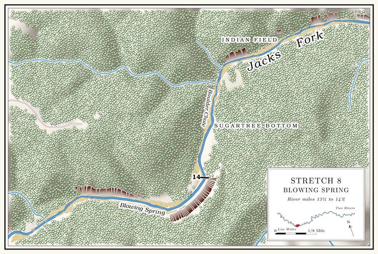
Blowing Spring Hole, Sugartree Bottom and Boulder Chute
Pool, bottom and chute · about miles 13.8 to 14.3 · Plate A5
Blowing Spring Hole, about 5 feet deep at Low Water. The local name for the Highway Y bridge over the South Prong, the access beside it and the county’s low-water crossing where the prongs meet, and so for the head of the river (Chapter 8; Chapter 18). Glossary →the pool’s depth below the riffle that holds it, measured on the 2021–23 riverbed survey (Heimann, Atkinson and High 2025; Map 12)., is known by a small, noisy spring. Below it, on the left, lies Sugartree Bottom, said to be named for the large sugar maples that once grew there. The river sweeps past a high cut bank of clay on the left into Boulder Chute, a long, narrow, rough run lined with large rocksLewis 1980, PDF pp. 30–31, the only source.. Up on the north side, a pond on the upland is lettered Gilmore PondPlate A5; USGS GNIS..
To the right the narrow ridge called Angel Ridge separates the river from Lost HollowLewis 1980, PDF p. 30.. Its river face is Angel Ridge BluffMDC, “Cliffs”; see Chapter 2. (Chapter 2).